How TM ONE SmartMap Data Geocoding & Reverse Geocoding Works
With TM ONE SmartMap, geocoding and reverse geocoding are made simple.

With TM ONE SmartMap, geocoding and reverse geocoding are made simple.
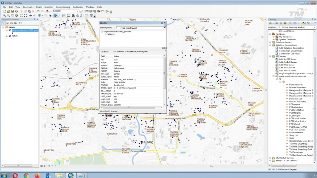
Geocoding and reverse geocoding data from Smartmap API can be used in GIS software, and a basemap layer can be applied to enhance the visual appeal of the data. It’s also possible to use SmartMap Tools to get geocoding and reverse geocoding data from GIS software that the user owns by activating them with API keys. This means that the user can get the data directly into their GIS software.
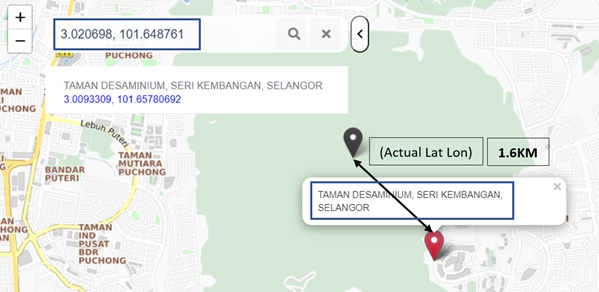
Geocoding is the process of transforming a description of a location such as a pair of coordinates, an address, or a name of a place to a location on the earth’s surface.